Starkweather Historic District
The Starkweather Historic District is within the Independence Heights community, just north of the North Loop segment of Interstate 610. The district is located on East 31½ Street between Yale Street and Cortlandt Street. Starkweather derived its name from F. W. Starkweather, who originally subdivided the land that is now East 31½ Street.
The district was developed between the late 1920s and 1940s by Edgar S. Phelps and his son, Edgar H. Phelps. These developers sold lots to African Americans looking to reside within the City of Independence Heights. While initially a separate municipality, Independence Heights was annexed to Houston in 1929. Independence Heights offered working and middle class African Americans the opportunity to live in better conditions than in Houston’s wards, while maintaining access to the central city by way of streetcar, jitney, and bus.
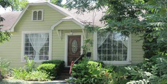
The district features modest frame dwellings typical of early 20th Century working and middle class suburbs. It features architectural styles that reflect both the prosperity of the late 1920s, as well as the economic difficulties associated with The Great Depression and World War II. While many of these homes have been altered from their original state, most of the district’s historic fabric remains intact.
The Starkweather Historic District was designated as a City of Houston Historic District on February 26, 2014. To learn more about Starkweather District, visit their website at www.starkweatherdistrict.org
